
Veo 3 Drone Shot Prompts: How to Create Aerial Camera Moves (2026)
Veo 3 drone shot prompts: aerial camera vocabulary, pull-back reveal, orbit, tracking shots, environment examples for real estate, travel, sports, and documentary.
Emma Chen · 14 min read · Jul 7, 2026
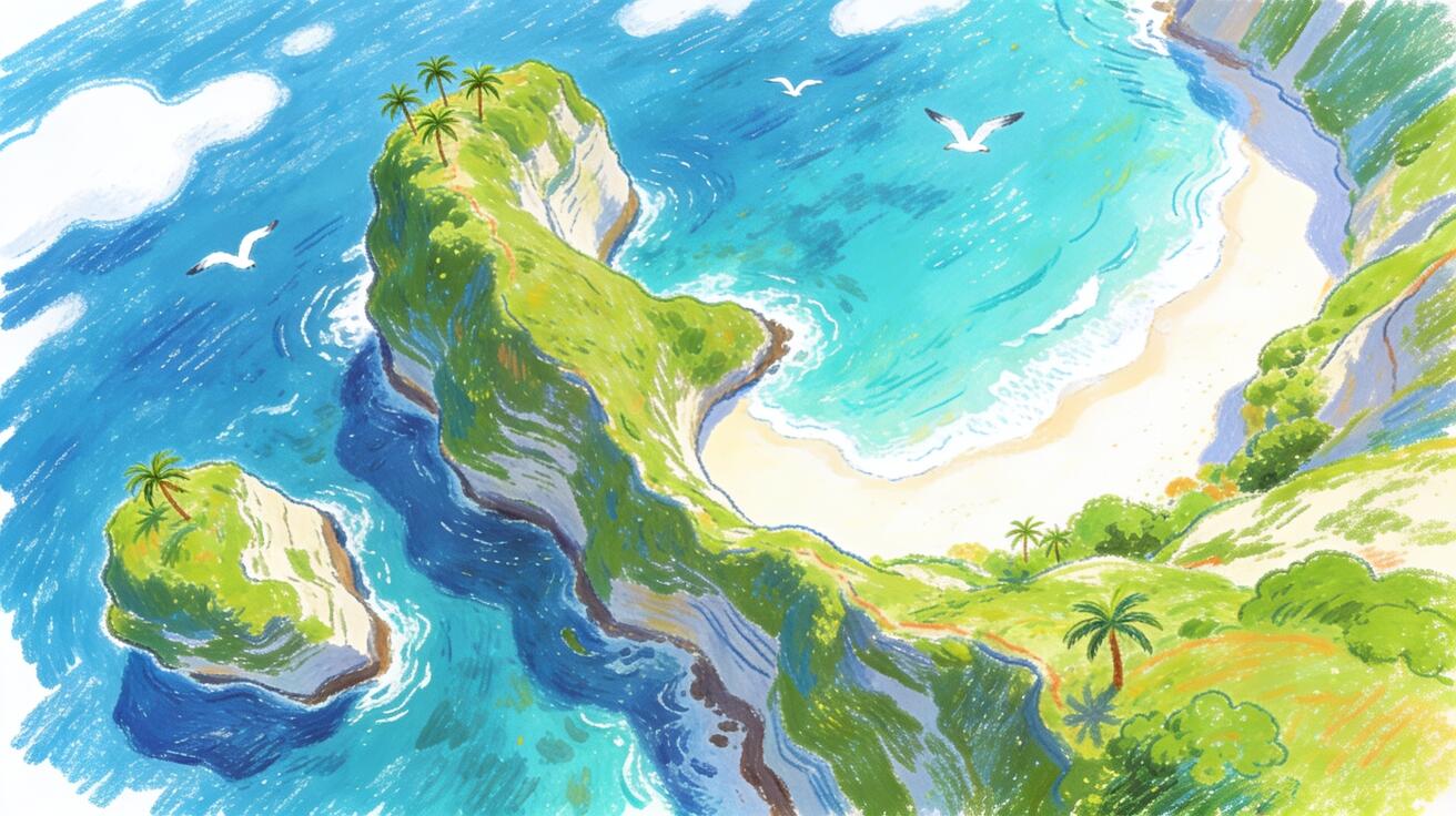
Veo 3 drone shot prompts simulate aerial camera movements without a physical drone. You describe the altitude, movement direction, and environment, and Veo 3 generates a clip that looks like it was filmed from above — a sweeping overview, a descending reveal, an orbit around a landmark. This guide covers the drone shot vocabulary that works in Veo 3, prompt templates for the most useful aerial moves, environment-specific examples, and how to use drone-style shots in real content workflows.
Why Use Veo 3 for Aerial and Drone-Style Shots
Real drone footage has significant logistics: a licensed operator, location permits in most countries, weather dependency, and safety restrictions around populated areas. Even stock drone footage has limitations — you need a shot that matches your exact subject, environment, and lighting.
Veo 3 generates aerial shots from a text description. You specify the environment, altitude, movement direction, and atmosphere, and the model generates a clip with cinematic aerial camera work. The result is an 8-second clip at 1080p with native audio (wind, ambient environmental sound) that you can use immediately.
This approach works best for establishing shots, location reveals, and scene-setting footage where the aerial perspective adds scale and context. It's less effective for shots that need to show a specific real-world location accurately, or where precise GPS coordinates matter. For creative content, marketing footage, and narrative establishing shots, Veo 3 aerial prompting is production-ready.
Core Drone Shot Vocabulary
Veo 3 responds reliably to these aerial camera terms:
Altitude and angle:
- "Bird's-eye view / aerial top-down" — straight down, directly overhead
- "High altitude establishing shot" — high wide view showing landscape scale
- "Low-altitude flyover" — close to the ground, faster sense of speed
- "Medium altitude, 45-degree angle" — the classic drone aesthetic: above and slightly forward-facing
Movement types:
- "Drone pulling back and ascending" — reveals the scene by moving away and up simultaneously; the most dramatic reveal move
- "Drone tracking forward at altitude" — moves toward the horizon, creates a sense of journey
- "Drone orbit / arc" — circles around the subject at constant altitude; good for architectural and landscape subjects
- "Drone descending slowly toward the scene" — lands the viewer in the environment; good for establishing location
- "Drone tilts down from horizon to overhead" — starts looking at horizon, tilts to bird's-eye; reveals geography
- "Crane-up" — starts low and rises vertically, revealing the environment height
Speed modifiers:
- "Slow and deliberate" — cinematic; good for dramatic environments
- "Smooth continuous drift" — no abrupt changes; feels controlled and professional
- "Fast flyover" — action/energy; good for sporting events, dynamic content
- "Hover" — stationary drone; good for holding on a scene
Drone Shot Prompt Templates
Pull-Back Reveal (Most Versatile Drone Shot)
This is the signature aerial move: start close and pull back to reveal the scale of the environment. It works for landscapes, architecture, and any subject where the "big picture" is the point.
[Subject at the center of frame] as a drone slowly pulls back and ascends, revealing [the larger environment].
Aerial perspective, starting at [starting altitude], ascending to [ending altitude] over [clip duration].
[Lighting conditions]. [Audio: wind + ambient].
Mountain landscape example:
A lone climber stands at a rocky summit as a drone slowly pulls back and ascends, revealing the full mountain range stretching to the horizon. Aerial perspective, starting 30 meters above the climber and ascending to 300 meters. Golden hour light, long horizontal shadows, slight atmospheric haze on the distant peaks. Low drone wind ambient, distant mountain silence, subtle orchestral score.
Coastal city example:
A historic lighthouse stands on a rocky promontory as a drone slowly pulls back and ascends, revealing the coastline, the city behind it, and the ocean stretching to the horizon. Aerial perspective, starting 50 meters above the lighthouse, ascending to 500 meters. Clear blue sky, midday light, sharp shadows. Ocean wind, distant surf, seagulls.
Urban architecture example:
A modern glass skyscraper reflects the sunrise as a drone slowly pulls back and ascends, revealing the full city skyline spreading in all directions. Aerial perspective, starting at the building's mid-level and ascending to reveal the full skyline. Golden sunrise light from the east, warm amber light on the glass facades. City ambient sound from below, wind at altitude.
Orbit Shot (Architecture and Landmarks)
The orbit shot circles the subject, revealing all sides. It works for any isolated subject: a building, a natural formation, a ship, a stadium.
Drone orbits [subject] at [altitude], circling from [starting angle] to [ending angle] over [clip duration].
[Subject description if not obvious]. [Lighting]. [Audio].
Arena orbit:
Drone orbits a large open-air stadium at 200 meters altitude, making a slow 180-degree arc from the north side to the south side over 8 seconds. The stadium is lit for a night event, lights blazing inside, surrounding parking lots visible below. City light ambient, crowd roar from inside the arena, subtle atmospheric wind.
Island orbit:
Drone orbits a small tropical island from 150 meters altitude, completing a slow 270-degree arc. The island has a white sand beach on the windward side, dense palm forest in the center, and a reef visible in the clear turquoise water around it. Clear afternoon light, slight haze. Ocean wind, distant surf, tropical bird call.
Tracking Forward Shot (Journey and Scale)
The drone tracks forward at altitude, conveying travel and distance. Good for opening title sequences, destination content, and any narrative that benefits from a sense of movement.
Drone tracks forward at [altitude], moving toward [destination/horizon/subject].
[Environment description]. [Lighting]. [Audio: wind + ambient].
Desert highway:
Drone tracks forward at 80 meters altitude along a straight highway cutting through a vast desert, moving toward the horizon. The road narrows to a point in the distance, red rock formations on both sides, no traffic visible. Late afternoon light, long shadows parallel to the road, dust haze. Desert wind, distant emptiness, subtle low drone tone.
Forest flyover:
Drone tracks forward at 30 meters altitude over an old-growth forest canopy, moving through the treetops at low altitude, barely clearing the tallest trees. Dense mixed forest below, patches of sunlight breaking through gaps. Afternoon golden light. Wind through the canopy, birds, rustling leaves.
Descending Reveal (Location Arrival)
The drone descends toward a subject, placing the viewer into the scene. Good for arrival sequences and location reveals.
Drone descends from [starting altitude] toward [subject/location], ending at [ending altitude/position].
[Environment]. [Lighting]. [Audio].
Coastal town descent:
Drone descends from 400 meters altitude toward a small fishing village on a cliff above the sea, ending at 30 meters above the harbor. The village has terracotta rooftops and a winding harbor road. Late afternoon light, golden warm tones. Wind at altitude gradually giving way to harbor ambient: boat engines, seagulls, water.
Environment-Specific Aerial Prompt Examples
Urban and Architecture
City skyline at dawn:
Bird's-eye aerial view of a major city at dawn, camera slowly drifting forward at 500 meters altitude. City lights still on from the night, sunrise beginning to pink the eastern sky. Cool morning light with warm eastern horizon. City ambient at altitude, distant traffic hum.
Historic old town:
Aerial view of a medieval old town from 150 meters altitude, drone slowly orbiting the central cathedral plaza. Terracotta rooftops, narrow streets, morning market just beginning in the square below. Morning light, soft shadows. Church bells, market ambient from below, light wind.
Natural Landscapes
Winter mountain valley:
Drone tracks forward at 200 meters altitude through a snow-covered mountain valley in winter. Pine forest on both sides, a frozen river visible below, mountain peaks ahead. Overcast diffuse winter light. Wind, snow ambient, complete silence below.
Tropical coastline:
Drone tracks forward at 100 meters altitude along a tropical coastline, ocean on the left, lush green jungle on the right. Clear turquoise water with visible reef patterns below the surface. Midday bright light. Ocean wind, waves breaking on the reef, tropical birds.
Wheat field at harvest:
Drone pulls back from low altitude above a golden wheat field at harvest time, ascending to 200 meters to reveal the patchwork of fields, farm structures, and a small road cutting through the landscape. Late summer afternoon light. Combine harvester ambient faintly below, wind through wheat, open agricultural landscape quiet.
Water and Marine
River winding through landscape:
High-altitude aerial view of a river winding through a broad agricultural valley. Drone tracks slowly forward following the river's course. Farmland on both sides, small bridges visible. Clear afternoon light, slight atmospheric haze in the distance. Wind, distant water ambient.
Open ocean:
Aerial bird's-eye view of open ocean, camera drifting slowly forward at 200 meters altitude. Deep blue water with white caps, sun reflecting off the surface as a glittering path. Bright midday sun, slight backlight shimmer. Ocean wind, waves below.
Combining Drone Shots with Other Content
Drone shots are most effective as part of a content sequence, not in isolation. Common patterns:
Establishing + ground level: Open with an aerial pull-back establishing shot (created in Veo 3), cut to a ground-level scene (filmed conventionally or also generated in Veo 3). The combination gives cinematic scale while keeping the narrative close to the subject.
Drone arrive + interior: Start with a drone descending onto a location, cut to the interior of the building or space. Used in real estate, hospitality, and travel content to orient the viewer before going inside.
Journey montage: Multiple drone tracking shots through different environments, assembled to convey travel and distance. Each clip is 6–8 seconds of tracking at altitude; assembled in an editor they tell a journey narrative.
Platform-Specific Drone Shot Applications
Real Estate and Architecture
Real estate video benefits significantly from aerial context. A property's relationship to its surroundings — nearby water, parks, city center proximity, neighborhood layout — is difficult to convey at ground level but immediately apparent from the air.
Standard real estate aerial sequence:
- High aerial establishing shot showing neighborhood location (track forward toward property from altitude)
- Medium altitude orbit around the property
- Descending shot landing at the front entrance
Prompt for residential property approach:
Drone descends slowly from 200 meters altitude toward a modern two-story house with a cedar deck and lush backyard garden, ending at 15 meters above the roofline. The property's relationship to neighboring houses, the garden, and the street is visible throughout the descent. Clear midday light, warm and bright. Suburban ambient: distant lawn mowers, birds, light breeze.
Commercial property orbit:
Drone orbits a contemporary office park from 100 meters altitude over 8 seconds, revealing the glass-facade building, parking structure, and surrounding green landscape. Architectural photography lighting: even overcast diffuse light, no harsh shadows. Near-silent except for wind ambient at altitude.
Travel and Tourism
Tourism content needs aerial shots that sell a destination: the beach, the mountains, the city from above. These shots establish scale and aspiration.
Island resort establishing shot:
Drone tracks forward at 80 meters altitude along a white-sand beach, palm trees and resort bungalows on the right, turquoise ocean on the left. The shot moves toward a prominent headland visible ahead. Bright afternoon tropical light. Ocean ambient, light tropical wind, distant resort activity.
Mountain resort:
Drone pulls back from 50 meters above a ski resort base area, ascending to 400 meters to reveal the full mountain, ski runs, and surrounding mountain range. Late afternoon winter light, warm golden light on snow. Wind, ski run ambient noise fading as altitude increases.
Documentary and Storytelling
Documentary aerial shots establish geography and scale. They answer the question: "Where are we, and how big is this?"
Agricultural documentary:
High-altitude aerial overview of vast farmland, drone tracking forward slowly to reveal the patchwork of crop fields stretching to the horizon. Early morning light, low-angle sun creating long shadows across the rows of crops. Wind, agricultural ambient, distant machinery.
Industrial facility:
High aerial bird's-eye view of a large industrial facility — warehouses, loading docks, rail lines, and access roads. Drone drifts slowly forward at 300 meters altitude. Overcast diffuse light, accurate industrial textures. Factory ambient from below, wind at altitude.
Conservation and environment:
Aerial view of a river delta where multiple channels spread through a protected wetland area. Drone tracks slowly forward at 150 meters altitude following the main channel. Golden hour light, rich warm tones reflecting in the water. Wind, water ambient, distant bird calls.
Sports and Events
Sports aerial shots show scale, field of play context, and crowd energy from a perspective that ground-level footage can't provide.
Stadium exterior pre-event:
Drone orbit of a large sports stadium from 200 meters altitude, with crowds of people approaching the stadium from all sides visible below. Pre-event energy, late afternoon light. Crowd ambient building as the drone orbits.
Mountain bike trail flyover:
Low-altitude drone tracking forward at 20 meters above a mountain bike trail cutting through dense forest, moving fast through the trees. Dappled afternoon light through the forest canopy. Wind, tire on gravel, forest ambient — fast, energetic.
Marathon aerial overview:
High-altitude aerial overview of a city street marathon, drone slowly drifting forward along the route to reveal the column of runners stretching through the city blocks. Midday city light. City ambient from below, crowd cheering from finish line area in the distance.
Lighting in Aerial Shots
Lighting has a bigger impact on aerial photography than most ground-level shooting — the altitude changes how light interacts with the environment.
Golden hour aerial (the best drone lighting): "Golden hour light, low sun at 10 degrees above horizon, long horizontal shadows across the landscape, warm amber tones on any east-facing surfaces" — this is the signature look of cinematic drone footage. The low-angle light creates texture and depth in landscapes that flat midday light can't produce.
Overcast diffuse light: "Even overcast light, diffuse from above, no harsh shadows" — good for architecture and cityscapes where you want accurate representation without distracting shadows. The most reliable choice when you need the subject to look clean and professional.
Blue hour / twilight aerial: "Late twilight / blue hour light, city lights beginning to appear below, deep blue sky transitioning from sunset" — one of the most cinematic looks for urban aerial photography. Works well for city establishing shots.
Sunrise aerial: "Dawn light, first light warming the eastern horizon, landscape below still in partial shadow, golden light striking the highest points of the landscape" — good for dramatic natural landscape shots. Creates a sense of scale by showing the shadow line across the terrain.
Night aerial: "Night aerial, city lights spread across the landscape below, a grid of amber and white streetlights, dark sky above" — technically challenging but Veo 3 handles it well. The challenge is avoiding an overly dark or muddy look; specify "well-exposed night aerial, city lights bright and crisp."
Troubleshooting Common Aerial Prompt Failures
Horizon tilt: When the aerial shot has a tilted, off-level horizon, add "perfectly level horizon" to your camera direction. A tilted horizon is a common issue in AI-generated aerial footage and one of the clearest signs it's AI-generated.
Subject too small: If the subject gets lost in the frame, add "subject clearly centered and dominant in frame throughout the clip" to your prompt. In pull-back reveals, the subject can become too small before the environment is fully revealed.
No wind audio: Aerial shots without wind audio feel disconnected and fake. Add "sustained altitude wind ambient" or "light wind consistent throughout" explicitly. The model defaults to lower-wind audio at ground level.
Horizon instability: The horizon wobbles or shifts unpredictably during the clip. Add "smooth and stable camera movement, no wobble or drift in the horizon" to your prompt.
No scale reference: Without a recognizable object (a person, a road, a building) for scale reference, aerial shots lose their sense of altitude. Include a recognizable scale object in your scene description: "a single figure visible far below," "cars visible on the road below," "the shadow of the drone barely visible on the ground."
QA Checklist for Veo 3 Drone Shots
Before publishing any aerial clip:
- [ ] Horizon is level (not tilted unless intentional)
- [ ] Camera movement is smooth throughout the clip — no sudden jerks or jitter
- [ ] Audio includes wind ambient appropriate for the altitude depicted
- [ ] Subject is visible in the first frame (don't start with a blank sky)
- [ ] Lighting is consistent from start to finish
- [ ] No obvious AI artifacts (sudden object appearance/disappearance, floating elements)
Conclusion
Veo 3 drone shot prompts give you aerial camera work without a physical drone, operator, or permit. The pull-back reveal, orbit, and tracking forward shots cover the majority of drone content use cases, and Veo 3's native audio adds the atmospheric wind and ambient sound that makes aerial footage feel immersive.
Start with the pull-back reveal — it's the most universally applicable drone shot — and use the prompt templates above for the specific environment you're creating. Try it at veo3ai.io, or see the Veo 3 cinematic prompts guide for more camera direction vocabulary, and the Veo 3 tutorial for beginners for the full workflow overview.
Related Articles
Continue with more blog posts in the same locale.
Veo 3 Talking Head Video: How to Create AI Presenter Videos (2026)
Create AI presenter videos with Veo 3: character prompts, lip sync, platform formats, brand spokesperson, social persona, and training video host — with ready-to-use templates.
Read article
Veo 3 for E-Commerce: AI-Generated Product Videos That Convert (2026)
Learn how to use Veo 3 for e-commerce product video: I2V packshot prompts, platform specs, category playbooks for fashion, food, cosmetics, and home goods, plus QA checklists.
Read article
Veo 3 Vertical Video (9:16): How to Make Portrait Clips for TikTok, Reels & Shorts
How to make vertical 9:16 Veo 3 videos for TikTok, Reels, and Shorts — native generation, the API aspect-ratio parameter, prompt framing, copy-ready prompts, and a full workflow.
Read article